

More Top Stories


Solar power battery repairs ‘could take up to 12 months’
15 April 2024


Police shortage leads to drop in checkpoints
9 April 2024


Sarakura declared new Penrhyn MP
16 March 2024


Govt says $1.3m invested in Lady Samoa charter
22 February 2024


Mass milkfish die-off in Penrhyn raises concerns
3 April 2024

Regulator defends Starlink users
9 April 2024


Aitutaki’s heritage preserved in new anthology
4 January 2024

Avatiu Eels retain Nines title
8 January 2024

Beddoes crowned top athlete
8 January 2024

NRL player Dargan dies in Aitutaki motorcycle crash
24 December 2023

‘Please heed the signs’: resident makes plea to tourists
20 December 2023

Cook Islands set to play in new World Series
10 October 2023


Corruption report exposes ‘bribe and sexual favours’
17 January 2023
Corruption in the Cook Islands?
21 January 2023

Moana target 2025 World Cup
11 November 2022
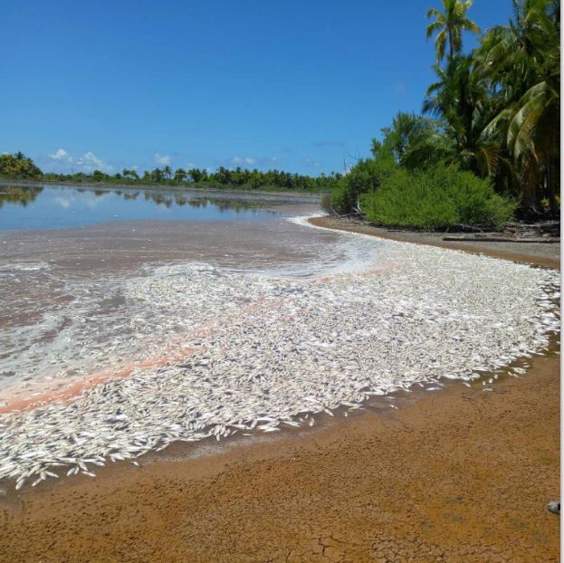
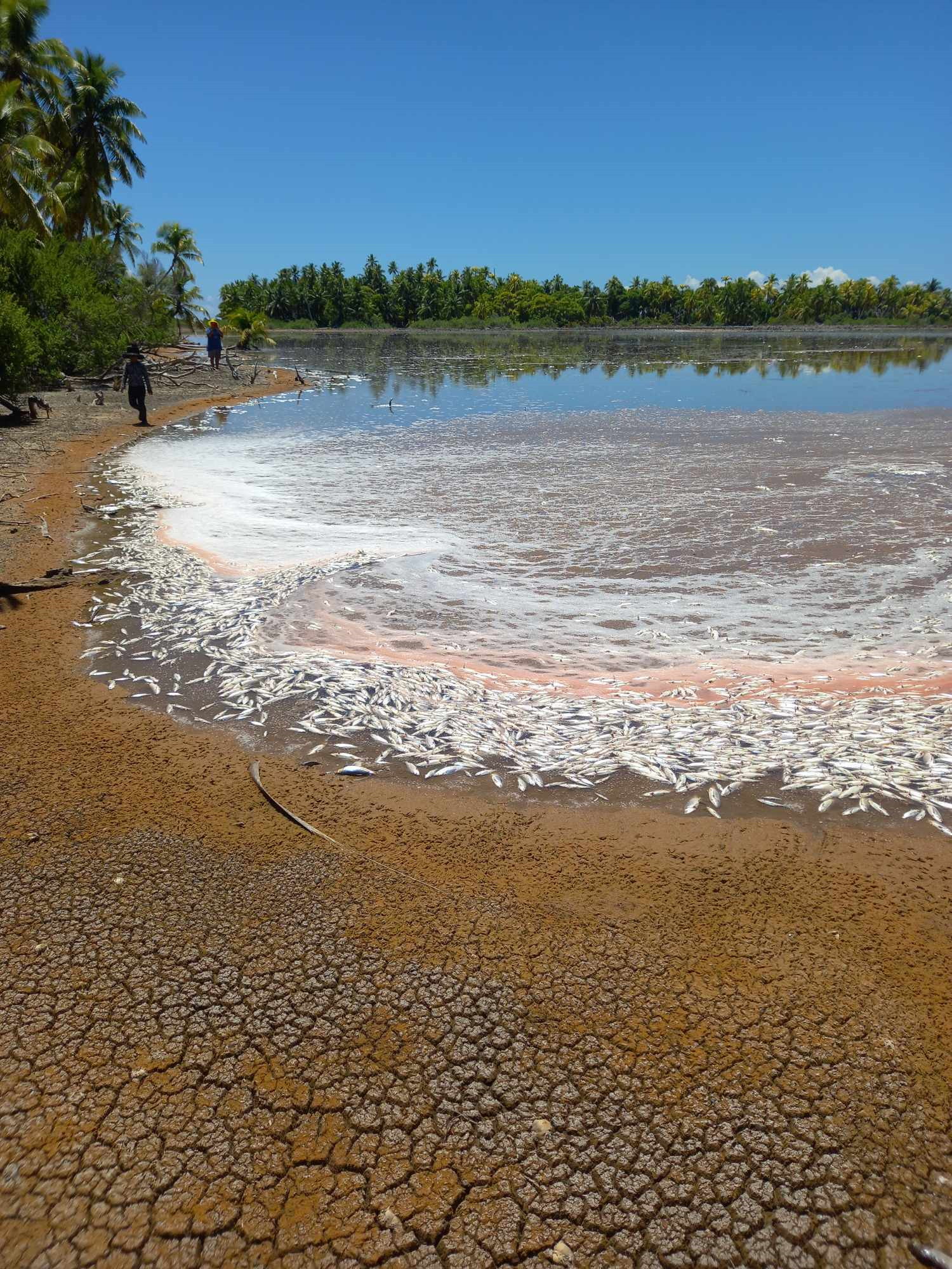
Penrhyn experienced a scorching 33 degrees Celsius at 2pm on April 2. Penrhyn residents were disturbed to discover hundreds of dead milkfish washed up on the beach on Easter Monday. SUPPLIED / 24040209 / 24040210
Cook Islands recorded its highest temperature of 33.1 degrees Celsius on March 27, says the weather office.
The previous highest temperature was 32.9 degrees Celsius recorded on March 19.
March proved to be the hottest month for the Cook Islands so far. Temperatures have started to ease, especially in Rarotonga, which received some rain over the weekend.
Cook Islands Meteorological Service operational observer Nathan Tisam said that during the Easter long weekend a week ago, between Good Friday to Easter Monday, temperature in Rarotonga was around 28 degrees Celsius through the night and then got up to an average of 32 degrees around midday.
However, Tisam said Penrhyn experienced a scorching 33 degrees Celsius at 2pm on April 2.
Also read: Mass milkfish die-off in Penrhyn raises concerns
According to the weather office climate summary for last month, the mean maximum temperature was 31 degrees Celsius with minimum temperature being 25.1 degrees Celsius. The total rainfall for last month was 119.3 millimetres where the highest rainfall was 55.1mm on March 10.
In explaining the situation of normal sea/high surface temperatures in the northern group, Tisam said that it refers to the temperature range observed in a particular location over a period of time.
He noted that sea surface temperatures are particularly affected during active ENSO (El Niño-Southern Oscillation) phases.
“In the context of El Niño (the current ENSO phase we are experiencing) high surface temperatures in the equatorial Pacific ocean are a key characteristic,” Tisam said.
“During El Niño events, sea surface temperatures in the central and eastern Pacific become anomalously warm as trade winds weaken and warm water is pushed eastwards towards us, disrupting normal weather patterns globally.”
Tisam said these elevated sea surface temperatures could influence atmospheric circulation, leading to shifts in precipitation patterns.
He earlier stated that the heat waves could have significant impacts on weather patterns leading to shifts in weather patterns. These includes changes in wind direction and intensity and warm ocean temperatures leading to increased evaporation, which could fuel storms and precipitation in nearby areas.
They can also disrupt marine ecosystems, with higher temperatures affecting coral health (coral bleaching) which subsequently affects fish populations.