

More Top Stories


Solar power battery repairs ‘could take up to 12 months’
15 April 2024


Police shortage leads to drop in checkpoints
9 April 2024


Sarakura declared new Penrhyn MP
16 March 2024


Govt says $1.3m invested in Lady Samoa charter
22 February 2024


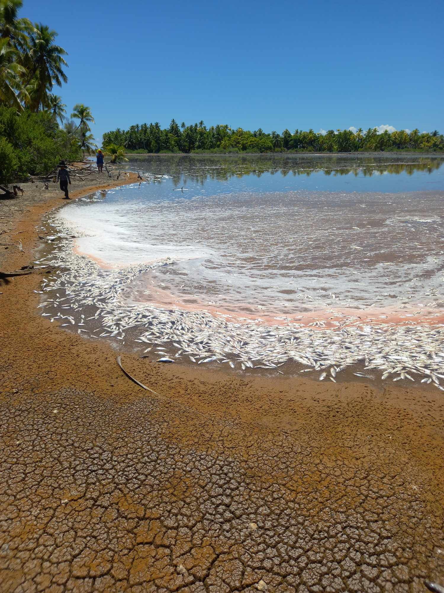
Mass milkfish die-off in Penrhyn raises concerns
3 April 2024

Regulator defends Starlink users
9 April 2024


Aitutaki’s heritage preserved in new anthology
4 January 2024

Avatiu Eels retain Nines title
8 January 2024

Beddoes crowned top athlete
8 January 2024

NRL player Dargan dies in Aitutaki motorcycle crash
24 December 2023


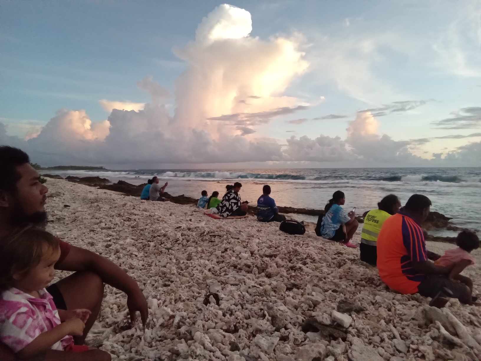
‘Please heed the signs’: resident makes plea to tourists
20 December 2023

Cook Islands set to play in new World Series
10 October 2023


Corruption report exposes ‘bribe and sexual favours’
17 January 2023
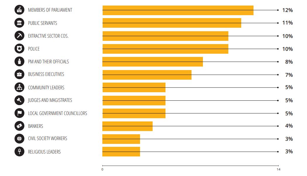
Corruption in the Cook Islands?
21 January 2023

Moana target 2025 World Cup
11 November 2022
MANILA – A powerful Pacific-born typhoon has swept across the Western Pacific after making landfall in the north-east of the Philippines as a “super typhoon”, before weakening and moving towards Taiwan.
Typhoon Noul, also known as Dodong, was packing winds of up to 160 kilometres per hour near the centre, with gusts of up to 195 kilometres per hour.
The Federated States of Micronesia is also assessing the damage from Noul when it passed through as a slow moving storm last week.
The Philippine Atmospheric, Geophysical and Astronomical Services Administration said the typhoon made landfall over Pananapan Point in Cagayan province.
Meteorologists said the typhoon slowed just before it reached the Philippines’ north-eastern coast, where it made landfall late on Sunday afternoon.
The eye of the storm has now travelled 100 kilometres north-east of Aparri, towards the Balintang channel which separates the Philippines and Taiwan.
Officials warned of landslides and called on residents along the coast to evacuate to safer ground.
“We strongly advise pre-emptive evacuation while we still have time, and we expect there will be a confluence of events – a high tide, heavy rainfall in the mountains, the possibility of a storm surge and strong winds,” national disaster agency head Alexander Pama earlier told a news briefing.
“Even as we speak, our armed forces are already moving to help in the evacuation.
“So too are our police forces who are conducting evacuations in their municipalities.”
The typhoon was expected to trigger landslides, flash flooding and storm surges of up to two metres in parts of the Cagayan Valley, the weather bureau said, adding that heavy to intense rainfall was likely within the typhoon’s 150-kilometre diameter.
The disaster agency said there could be landslides in at least 21 areas of Santa Ana in Cagayan Valley province and nearby Gonzalo town.
More than 5000 passengers and about 100 vessels were stranded in various ports in the country as of Saturday, mostly along its eastern seaboard.
Airline Cebu Pacific cancelled at least six domestic flights to the northern Philippines.
Officials in northern Philippine provinces have alerted rescue units and positioned relief goods.
The government readied trucks to ferry people away from low-lying and flood-prone areas.
In Taiwan, which is also in the storm’s predicted path, authorities warned sailors of strong winds and high waves and evacuated almost 1000 tourists from an island off the south-east coast.
“This is a very dangerous storm,” Philippines marine weather division head Rene Paciente said.
“It is the strongest so far this year.”
Officials warned that heavy rain from the typhoon could cause “lahar”, or flows of mud and debris, around Mount Bulusan, a volcano that has been spewing ash this week.
“There could be lahar flow, mudslides, that could sweep away houses in the area if there is heavy rain. That is the danger,” Esperanza Cayanan, division head at the weather bureau, told a briefing at the national disaster agency.
An average of 20 typhoons cross the Philippines each year, with the storms becoming fiercer in recent years.
More than 8000 people died or went missing and about 1 million were made homeless by Haiyan, a category-five typhoon that struck the central Philippines in 2013, bringing five-metre-high storm surges.