

More Top Stories
Solar power battery repairs ‘could take up to 12 months’
15 April 2024


Police shortage leads to drop in checkpoints
9 April 2024


Sarakura declared new Penrhyn MP
16 March 2024


Govt says $1.3m invested in Lady Samoa charter
22 February 2024


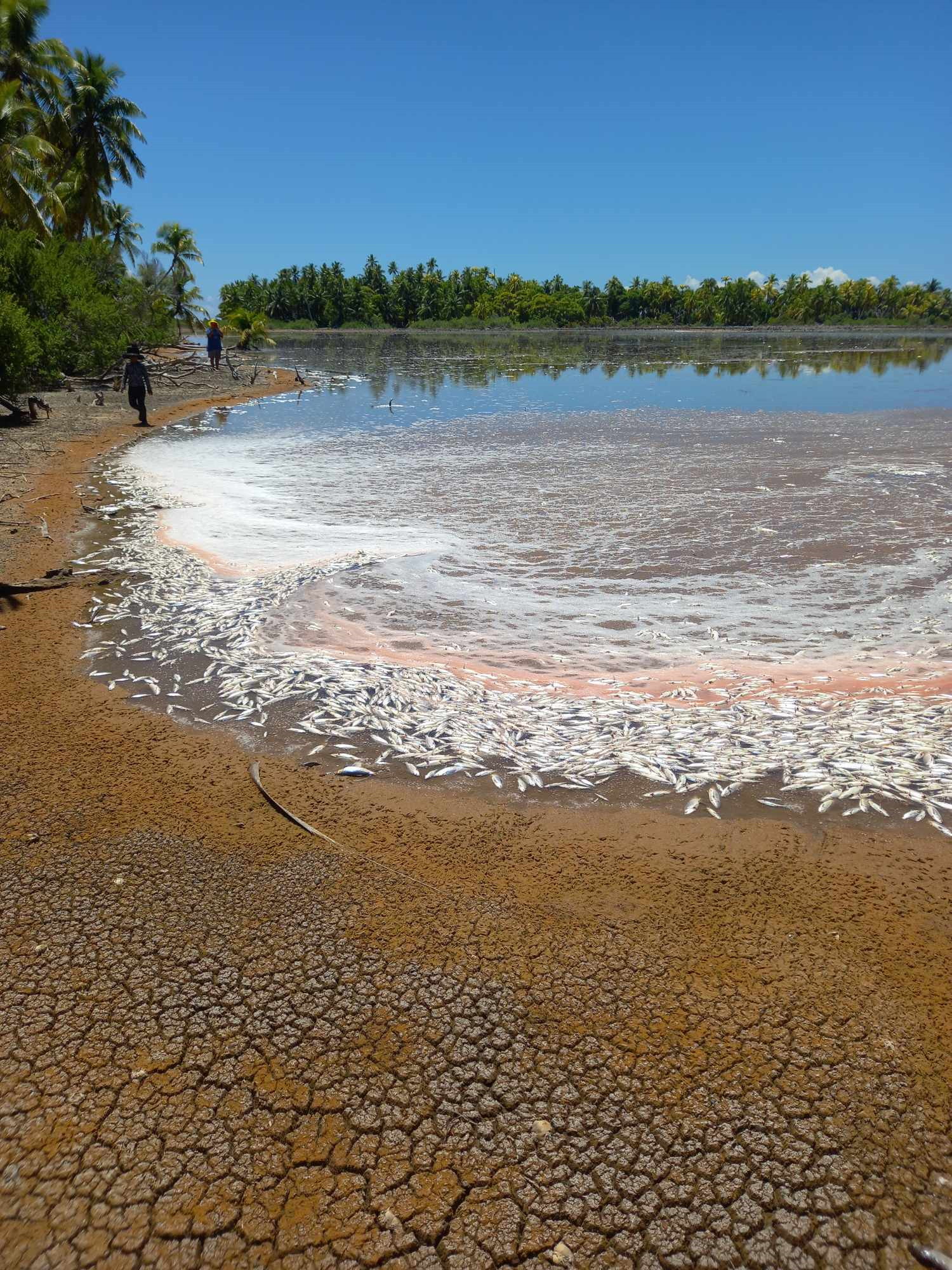
Mass milkfish die-off in Penrhyn raises concerns
3 April 2024

Regulator defends Starlink users
9 April 2024


Aitutaki’s heritage preserved in new anthology
4 January 2024

Avatiu Eels retain Nines title
8 January 2024

Beddoes crowned top athlete
8 January 2024

NRL player Dargan dies in Aitutaki motorcycle crash
24 December 2023

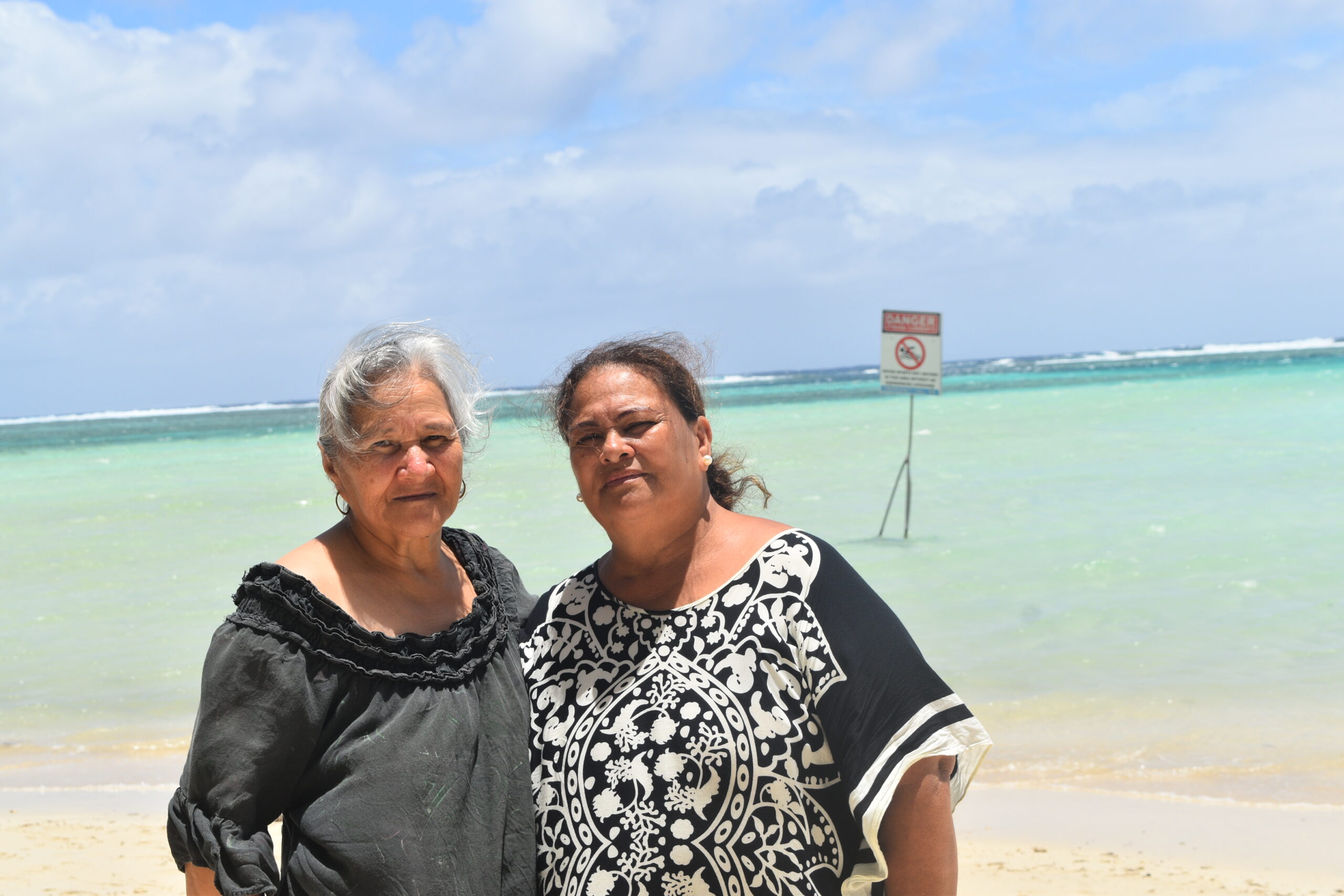
‘Please heed the signs’: resident makes plea to tourists
20 December 2023

Cook Islands set to play in new World Series
10 October 2023


Corruption report exposes ‘bribe and sexual favours’
17 January 2023
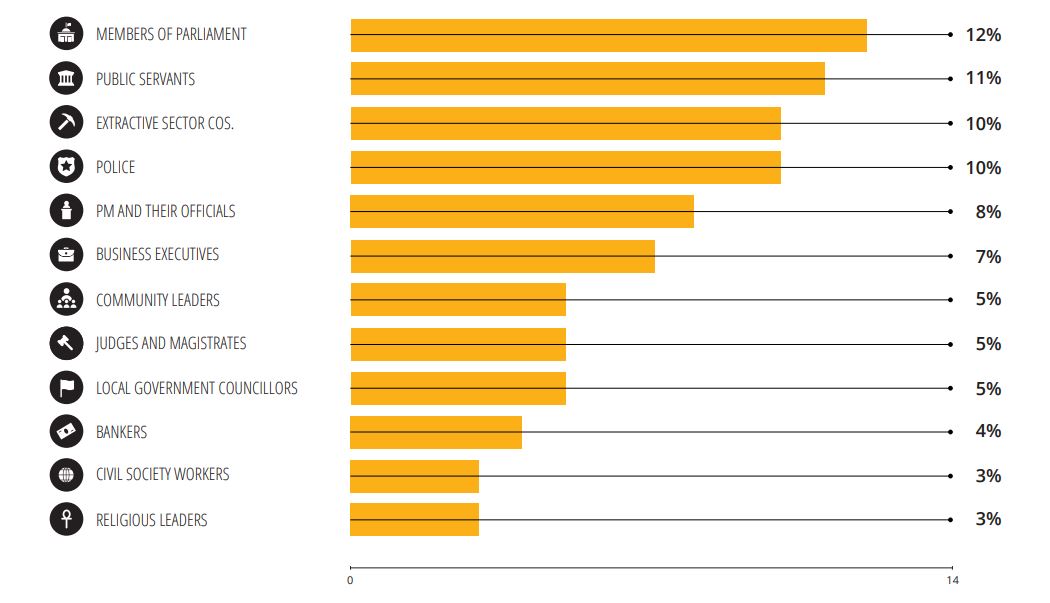
Corruption in the Cook Islands?
21 January 2023

Moana target 2025 World Cup
11 November 2022
PACIFIC – The extreme weather system known as El Nino is well underway, scientists say, and is forecast to be a “substantial and lasting phenomenon” with severe implications for either side of the Pacific Ocean.
The Australian Bureau of Meteorology, which monitors weather patterns across the tropical Pacific, upgraded its monitoring status to El Nino level for the first time in five years, and warned it is “likely to persist in the coming months”.
El Nino was expected amid record temperatures around the world last summer, but never fully materialised.
The US’s NOAA said its indicators suggested El Nino had arrived in early March – but then claimed it would only be ‘weak’.
With its arrival now confirmed by the Japanese Meteorological Agency and US scientists at NOAA, David Jones, climate monitoring and prediction chief at the Australian bureau, told reporters that this year’s effect will be “a proper El Nino, not a weak one”.
He said that while there was always an area of doubt with forecasts of intensity, “across the models as a whole we’d suggest this will be quite a substantial El Nino event”.
“El Nino conditions are now present in the tropical Pacific Ocean,” New Zealand’s MetService reported in March. “Cyclone Pam has produced one of the strongest reversals of the tropical trade winds seen in recent years.”
An El Nino event occurs when the prevailing trade winds that circulate over surface waters in the tropical pacific start to weaken.
This allows the warm waters of the western pacific to wash back eastward, dragging precipitation with it, resulting in droughts in some countries and heavy rains in others.
India, Indonesia and Australia are likely to become much drier, increasing the chances of wildfires, lower crop production and rising food prices.
The phenomenon is expected to precipitate heavier rainfall in South American and eastern Pacific nations, raising the prospect of floods and landslides.
Drought warnings are now in force for all of Tonga where drier than normal conditions are expected over the next six months.
Fua’amotu recorded 17.1mm, which is the lowest April rainfall in its record of 36 years. Nuku’alofa recorded 28.9mm which is the 3rd lowest April rainfall in its record of 71 years.
Fua’amotu is currently experiencing a drought that is ranked the third most severe amongst all those recorded and Nuku’alofa is ranked 10th most severe amongst all those recorded.
In Hawai‘i, rainfall was 40 per cent below normal at Honolulu for the first quarter of 2015, with all of the Hawaiian Islands in at least some stage of drought or abnormal dryness.
Record cold temperatures were felt in Honolulu with 14°C morning readings noted on March 10.
In addition, the Big Island of Hawai‘i had 29 consecutive days without rainfall from the end of January through the end of February, setting a new record dry spell.
El Nino is already impacting seriously in the western pacific with the Philippines this week placing eight provinces under a “state of calamity” due to a drought caused by the weather phenomenon.
The central Philippines province of Cebu is the latest addition to the list of areas which have been severely impacted by El Nino.
Farmers say forty per cent of their crops have been affected by the drought, and could lessen their crop production for the rest of the year.
A state of emergency allows its officials to use five per cent of more than US$2 million in local emergency funds to compensate for the losses of farmers.
Meteorologists say more than 50 provinces were beginning to suffer from the effects of the El Nino phenomenon.
They said the onset of the rainy season next month may not alleviate the impact of the drought.
Scientists at Australia’s weather bureau this month officially declared a major El Nino event due to an increase in sea surface temperatures in the Pacific Ocean.
It is likely to bring hotter temperatures and lower rainfall to much of eastern Australia.
Tropical cyclone activity in the western Pacific is expected to be above normal, which is typical during developing El Nino periods.
Most Micronesia islands will have about a one-in-three chance of serious effects from some combination of high winds, large waves, extreme rainfall associated with a typhoon during 2015.
More than 35 cyclones have occurred in previous strong El Nino years.
Forecasters are predicting five-to-eight storms in the Central Pacific in 2015. That’s up from the four-to-seven storms predicted in 2014.
The outlook calls for a 70 per cent chance of an above-normal cyclone season, a 25 per cent chance of a near-normal season, and a five per cent chance of a below-normal season.