

More Top Stories


Tapaitau appeal dismissed
17 July 2024

Challenging ‘rape culture’
8 July 2024

Ruta Mave: Can you trust your government?
22 July 2024


TB cases detected
1 June 2024


Touch trio ready for World Cup
23 May 2024


Man accused of raping minors face more charges
30 May 2024


‘Budget prioritises vulnerable’
16 May 2024


Alleged rapist in remand
27 April 2024

Rarotonga residents push back on water tariff plan
12 April 2024
Solar power battery repairs ‘could take up to 12 months’
15 April 2024
Cook Islands poised for highest Pacific growth
29 April 2024

Ex-DPM appeals ‘excessive sentence’, hearing date set
26 April 2024

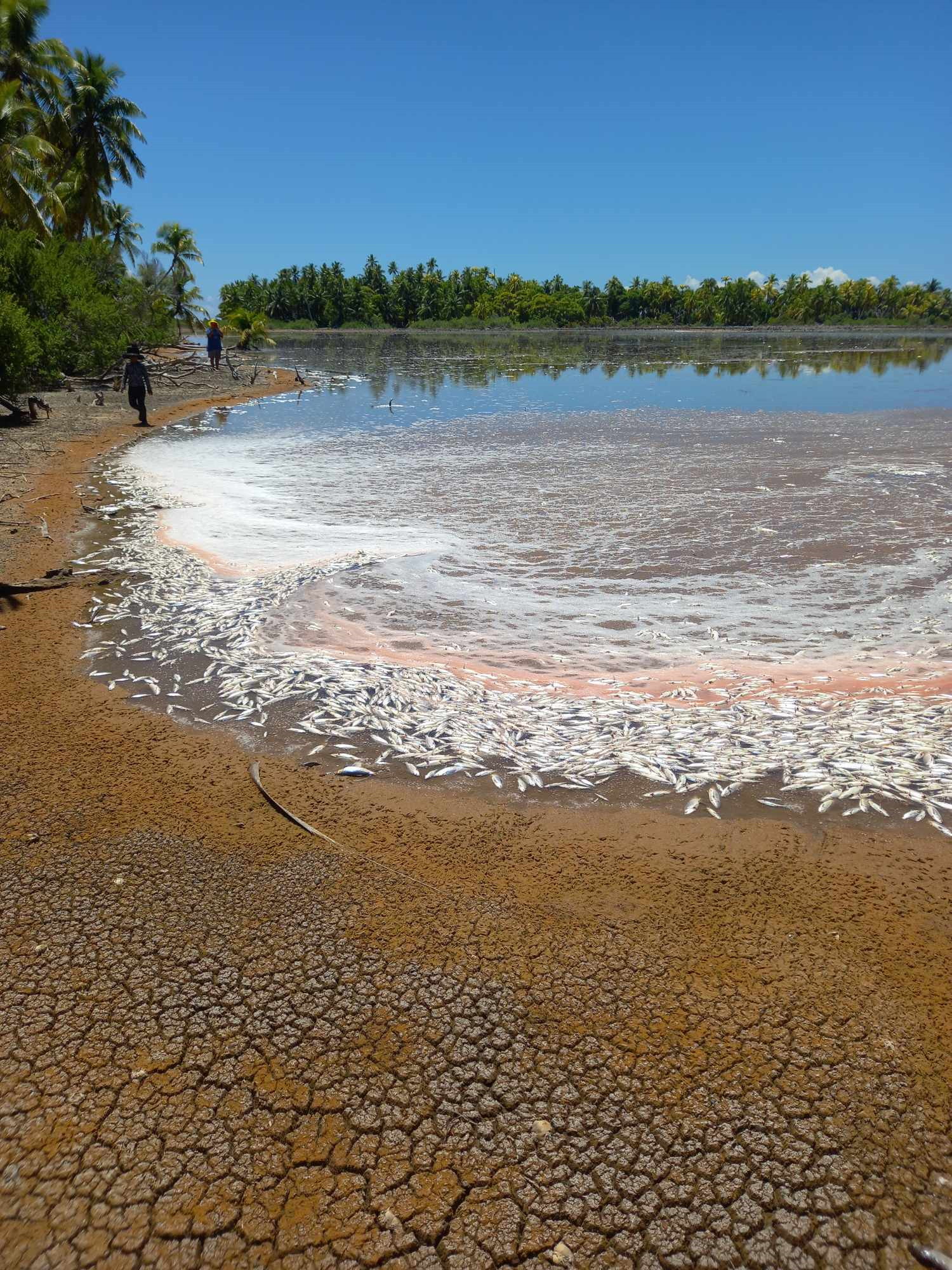
Mass milkfish die-off in Penrhyn raises concerns
3 April 2024

Regulator defends Starlink users
9 April 2024


Cook Islands set to play in new World Series
10 October 2023


Corruption report exposes ‘bribe and sexual favours’
17 January 2023

Moana target 2025 World Cup
11 November 2022
Cook Islands to benefit from new climate data project
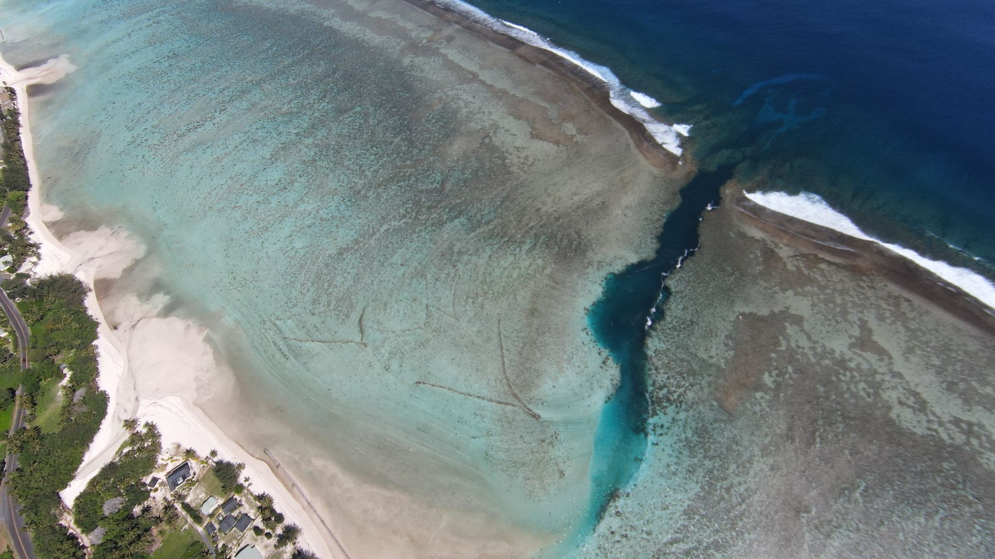
Friday 26 April 2024 | Written by Supplied | Published in National, Weather
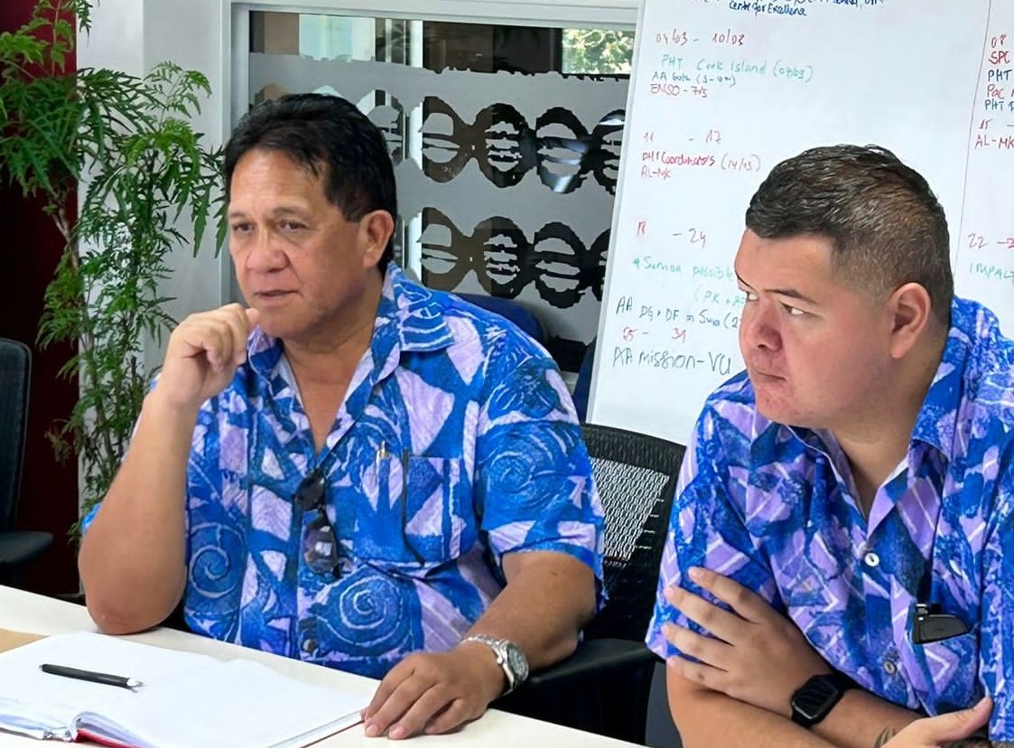
Emergency Management Cook Islands director John Strickland and Geoportal coordinator Stephano Rampling-Tou visit the OCHA office in Suva for the Pacific Humanitarian Team meeting, focused on preparedness and emergency coordination in the Cook Islands, last month. OCHA/24042404
Cook Islands will be one of the major beneficiaries of a new project, called Digital Earth Pacific, being developed to capture extensive satellite information about climate change and natural disasters in the region.
The project spearheaded by the Pacific Community (SPC) aims to provide reliable, detailed information about the connections between climate extremes and changes occurring on the Pacific islands.
According to a statement from global news agency Inter Press Service (IPS), the Pacific region harbours three of the world’s most disaster-prone countries, while eight are among those that suffer the highest disaster-related losses to Gross Domestic Product (GDP).
But decision-makers at all levels across the region are grappling with a lack of reliable, detailed information about the connections between climate extremes and changes occurring on their islands.
The project Digital Earth Pacific has been developed in a bid to bridge the deficit of data.
John Strickland, director of Emergency Management in the Cook Islands, said that the country was particularly prone to cyclones, flooding, sea surges, and drought.
“With 30 years of satellite data collected through Digital Earth Pacific … (it) has provided images of how the Cook Islands’ coastal area has been affected by climate change, also indicating water observations during floods,” Strickland told IPS.
“With the data captured, this will assist the Cook Islands in future planning on ensuring that affected coastal and low-lying areas affected by floods are captured and monitored. It will provide us the ability to report on affected areas and forecast, in the future, zones that are vulnerable during a disaster.”
SPC, the regional scientific and principal organisation, also believes that access to the data will aid economic growth by informing better investment and planning by local industries and businesses.
“This is a real first for the Pacific and will bring incredible value to the region, which is so vast, but managed and stewarded by a small number of overstretched people in our member governments,” Dr Stuart Minchin, Director-General of the Pacific Community in Noumea, New Caledonia, told IPS.
“Digital Earth Pacific provides a solution to the tyranny of distance that our Pacific people have to live with every day, allowing operational earth observation satellites to assist in monitoring and management of the vast Blue Pacific Continent.”
The Pacific Islands are home to about 12.7 million people and natural disasters are leading to annual average losses in the region of US$1.07 billion (NZ$1.8b), reports the Australian Aid Agency.
Digital Earth Pacific, launched by the Pacific Community in October last year, aims to halt that trend. To do this, it will set up far-reaching digital public infrastructure that gives national leaders, decision-makers, policymakers, and citizens, including farmers and local communities, easy access to up-to-date satellite-derived information. It will equip islanders to make better decisions about everything from building climate-resilient infrastructure to planting crops.
At this stage, the project will have operational products ready to use by 2024.