

More Top Stories


Tapaitau appeal dismissed
17 July 2024

Challenging ‘rape culture’
8 July 2024

Ruta Mave: Can you trust your government?
22 July 2024


TB cases detected
1 June 2024


Touch trio ready for World Cup
23 May 2024


Man accused of raping minors face more charges
30 May 2024


‘Budget prioritises vulnerable’
16 May 2024


Alleged rapist in remand
27 April 2024


Rarotonga residents push back on water tariff plan
12 April 2024

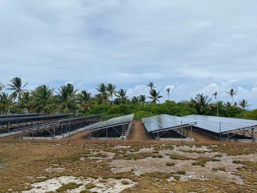
Solar power battery repairs ‘could take up to 12 months’
15 April 2024
Cook Islands poised for highest Pacific growth
29 April 2024

Ex-DPM appeals ‘excessive sentence’, hearing date set
26 April 2024

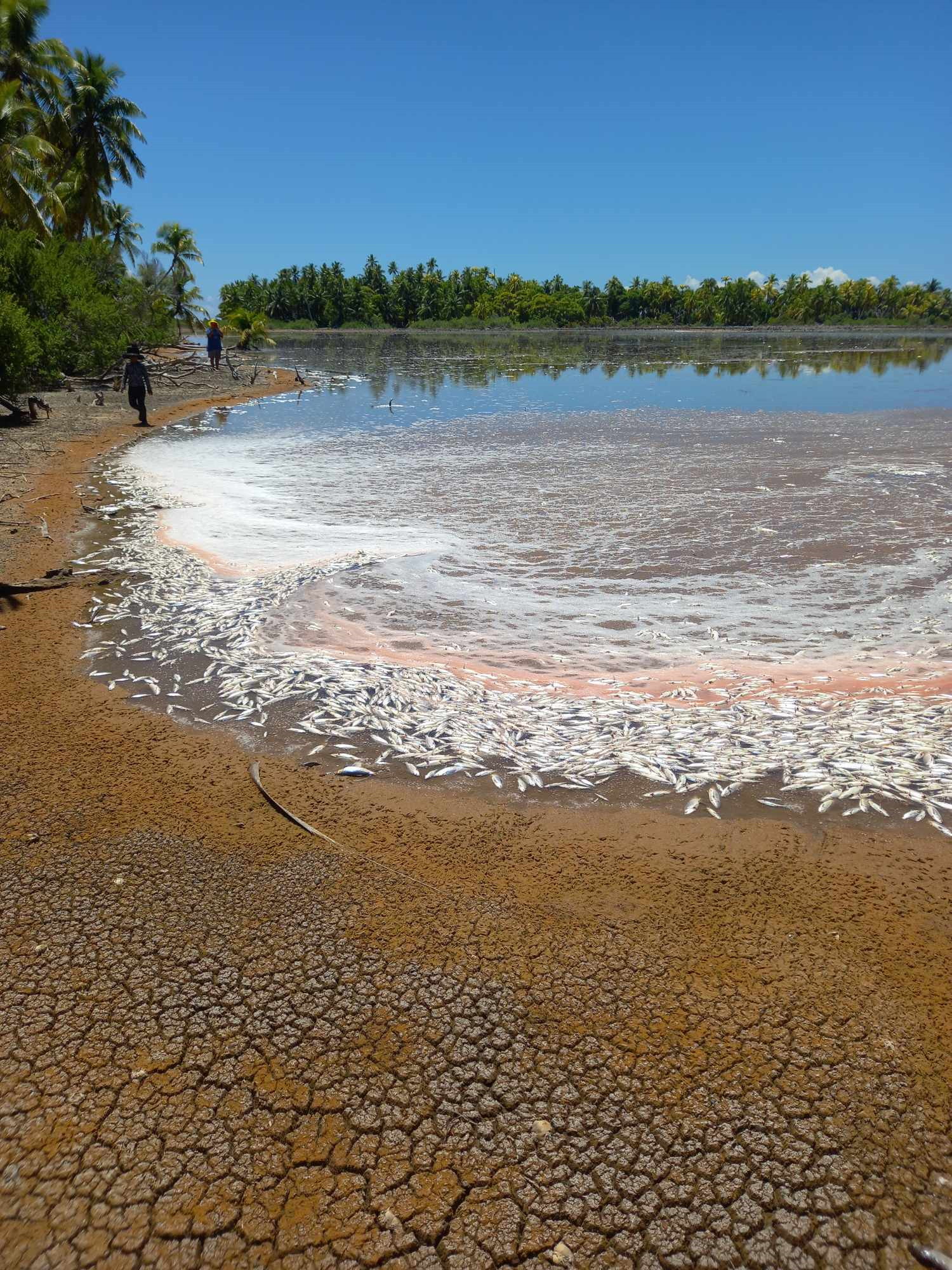
Mass milkfish die-off in Penrhyn raises concerns
3 April 2024

Regulator defends Starlink users
9 April 2024


Cook Islands set to play in new World Series
10 October 2023


Corruption report exposes ‘bribe and sexual favours’
17 January 2023

Moana target 2025 World Cup
11 November 2022
Weather system approaching Rarotonga to bring more rain
Friday 10 March 2023 | Written by Matthew Littlewood | Published in Local, National, Weather
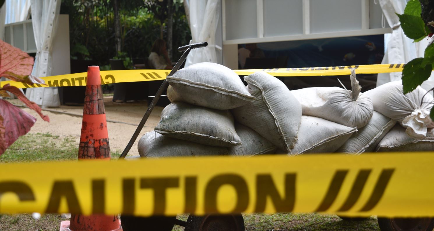
Sandbags were placed around parts of the Pacific Resort Rarotonga as rain persisted. Photo: AL WILLIAMS/23030922
A heavy weather system is making its way towards Rarotonga, bringing with it torrential rain.
Cook Islands Meteorological Service director Arona Ngari said the heavy rain was caused by a weather system “just north of Niue”.
“The forecast is that the system will make its way close to Rarotonga but won’t intensify,” Ngari said.
“The potential for it to turn into a Tropical Cyclone is very low.”
Ngari said the rain over the next couple of days would be similar to what happened on Thursday, where more than 30 millimetres fell.
“We’re expecting quite a bit of rain over the next few days, but things are forecast to subside by Sunday. The MetService will be monitoring the situation as it progresses,” he said.
Pacific Weather and Tropical Cyclones Updates (PWTCU) posted about the incoming weather system on their social media on Wednesday.
“This system is embedded within the active convergence zone extending from Rotuma to the Cook Islands,” the post says.
“This system lies in an area of favourable conditions with warm sea surface temperatures and low vertical wind shear, however due to its interaction with the convergence zone, this system is expected to remain weak and is not expected to develop into a Tropical Cyclone in the next 24-48 hours.
“However, this system together with the convergence zone will continue to bring some heavy rain and strong winds to Niue, Samoa, American Samoa, Wallis & Futuna and portions of the Cook Islands. It is expected to track east south-eastwards towards the Southern Cook Islands in the next two to three days.”
Emergency Management Cook Islands director John Strickland said there was “no cause for alarm” at the moment, but the organisation was nonetheless monitoring the situation.
“At the moment, we urge people to be vigilant and be aware of the weather system we’re experiencing,” Strickland said.
Pacific Resort group chief executive Marcus Niszow said it was putting staff through some training exercises in order to prepare for a major rain event.
“At the moment, things are looking okay, but we’re keeping a close eye on things and going through our regular checks,” Niszow said.
To Tatou Vai water authority spokesman Walter Tuarae-White said the recent rain which is likely to continue for a few days was “a welcome relief and boost to our intake-catchments”.
“We’ve had some big downpours and steady rain in between, which is what we ideally want. So, it soaks into the ground better rather than running off the hard surfaces from the recent dry period,” he said.
“It’s early days yet to gauge the levels across our 10 intakes but suffice to say, with the amount of rain we’ve had in the past 48 hours things are looking very positive. If the rain continues as forecast, we should be back up to optimum levels. The key is, we have several days of steady to heavy rain coming down to recharge our streams.”