

More Top Stories


Tapaitau appeal dismissed
17 July 2024


Challenging ‘rape culture’
8 July 2024

Ruta Mave: Can you trust your government?
22 July 2024


TB cases detected
1 June 2024


Touch trio ready for World Cup
23 May 2024


Man accused of raping minors face more charges
30 May 2024


‘Budget prioritises vulnerable’
16 May 2024


Alleged rapist in remand
27 April 2024

Rarotonga residents push back on water tariff plan
12 April 2024

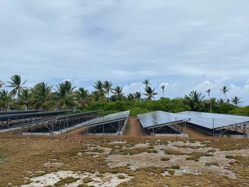
Solar power battery repairs ‘could take up to 12 months’
15 April 2024
Cook Islands poised for highest Pacific growth
29 April 2024

Ex-DPM appeals ‘excessive sentence’, hearing date set
26 April 2024


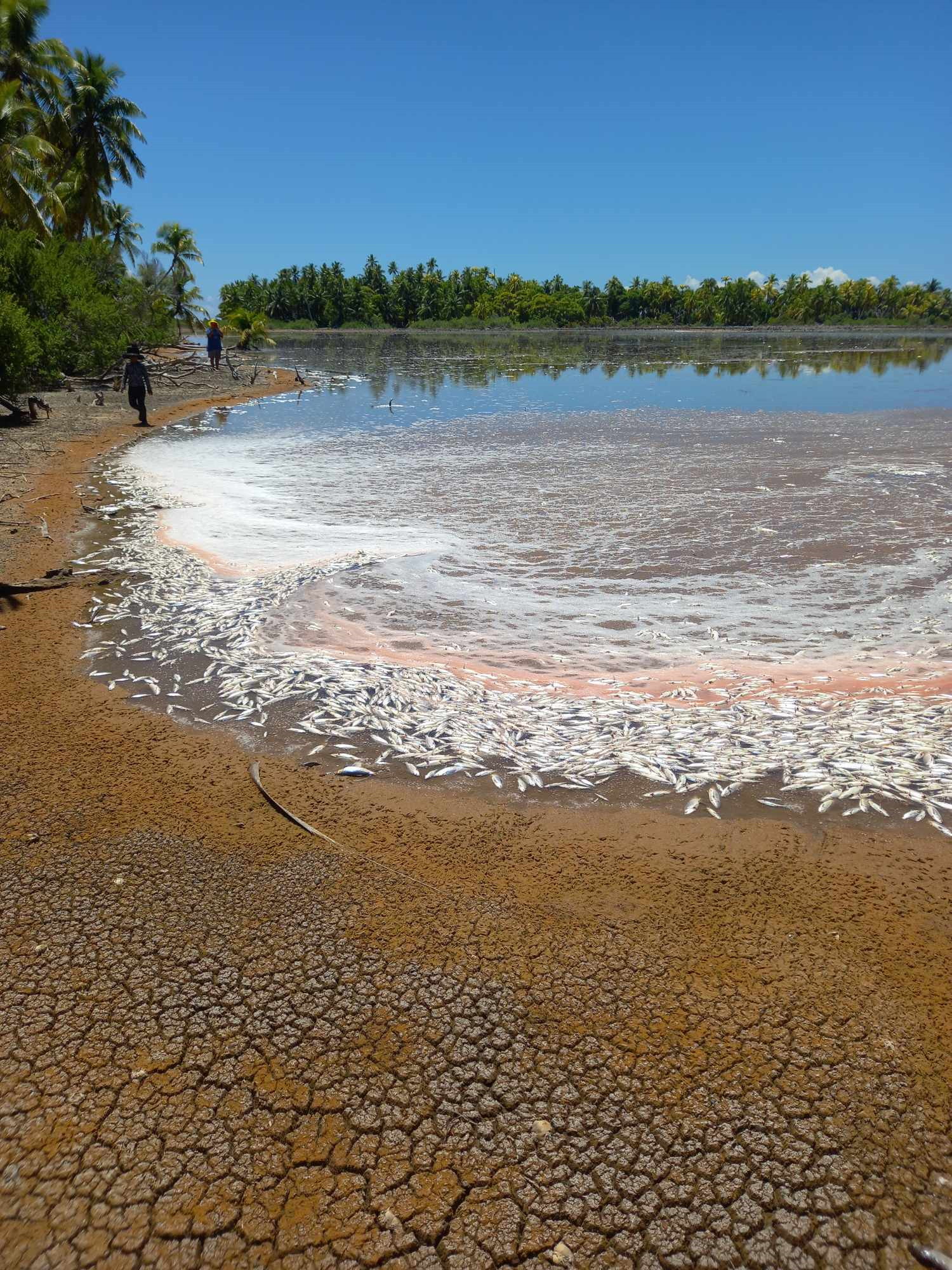
Mass milkfish die-off in Penrhyn raises concerns
3 April 2024

Regulator defends Starlink users
9 April 2024


Cook Islands set to play in new World Series
10 October 2023


Corruption report exposes ‘bribe and sexual favours’
17 January 2023

Moana target 2025 World Cup
11 November 2022
TC Nat set to hit the Southern Cooks now cancelled
Tuesday 6 February 2024 | Written by Losirene Lacanivalu | Published in Local, National, Outer Islands, Weather
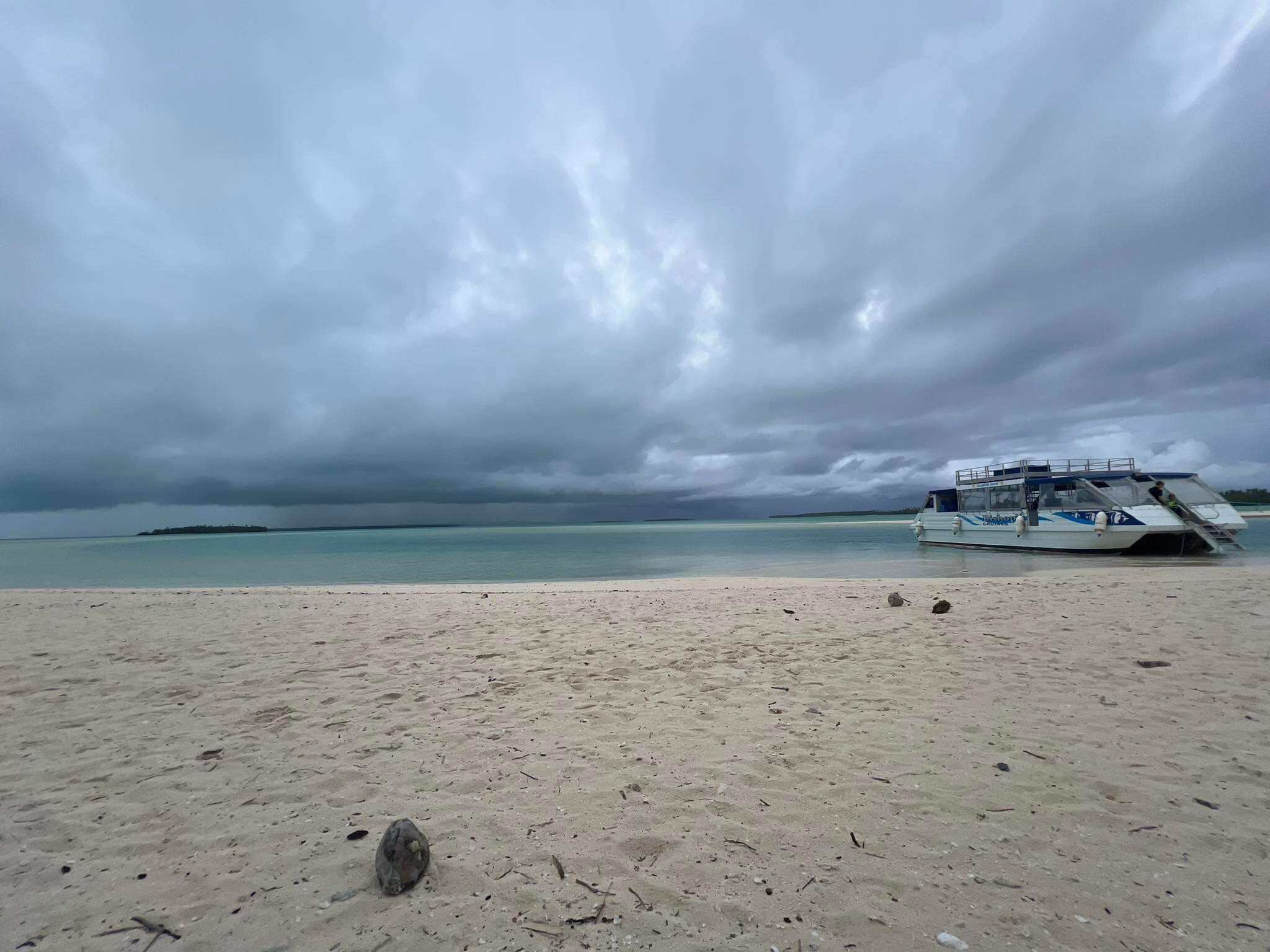
Aitutaki as of yesterday just after 12 noon. RASHNEEL KUMAR / 24020512 / 24020511
The weather warning that was in force for the northern waters of the Southern Cooks is now cancelled. The public is advised to remain vigilant as the Southern Cook Islands was set to feel the brunt of Tropical Cyclone Nat (N-E-T) as it was expected to have affected Aitutaki and Mauke last night.
Now a category 2 cyclone, TC Nat expected impacts, according to the weather office, include isolated damage to tree branches, and some houses of light materials or unshielded structures in exposed communities.
Poor visibility is expected for motorists in areas of heavy rain.
River and flash flooding of low lying and flood prone areas is expected.
There is a high risk of sea travel for all crafts.
Risky, hazardous breaking waves, and possible coastal inundation along low lying coastal areas, are also expected.
As of yesterday, Cook Islands Meteorological Service confirmed that tropical depression - TD06f was upgraded to a category one cyclone and later this morning a category 2.
As of last night, most islands in the Southern Group would have experienced strong winds of up to 40 kilometres an hour, and high seas.
Weather office operational observer Nathan Tisam said Aitutaki, Atiu, Mitiaro and Mauke would experience the brunt of TC Nat in the coming days.
On Sunday, Palmerston Island was already experiencing stronger winds and high seas with Aitutaki feeling the effects late last night as the category 1 system passed north west of the island.
Tisam said global models picked up TC Nat tracking in a south-easterly direction heading towards Atiu, Mitiaro and Mauke by early hours of Wednesday morning.
“Aitutaki and the Ngaputoru group are expected to experience gale force (63-87 km/h) winds, and coastal inundation associated with the rough seas.”
He said TC Pat was the last cyclone to come through Cook Islands and that was in 2010 whereby Aitutaki was affected.
The meteorological office had already predicted that Cook Islands would have up to three cyclones for the season, but especially during the El Nino event.
He said Cook Islands is historically susceptible to tropical cyclones like in the case of the 2005 season when TC Meena, Nancy, Olaf, Percy and Rae passed through the Cooks.
“As always, the public are advised to remain vigilant during these times. Have back up food and water supplies ready in case of emergency and secure houses and any items that can act as projectiles during strong wind events. Phone books will have emergency contacts as well as evacuation centres and a TC Tracking map.”
Airport Authority Cook Islands chief executive Nikau Tangaroa said as of yesterday, Aitutaki Airport and Rarotonga Airport were operating- business as usual.
Tangaroa said they had their team monitoring the situation pertaining to TC Nat and would advise accordingly.