

More Top Stories


Solar power battery repairs ‘could take up to 12 months’
15 April 2024


Police shortage leads to drop in checkpoints
9 April 2024


Sarakura declared new Penrhyn MP
16 March 2024


Govt says $1.3m invested in Lady Samoa charter
22 February 2024


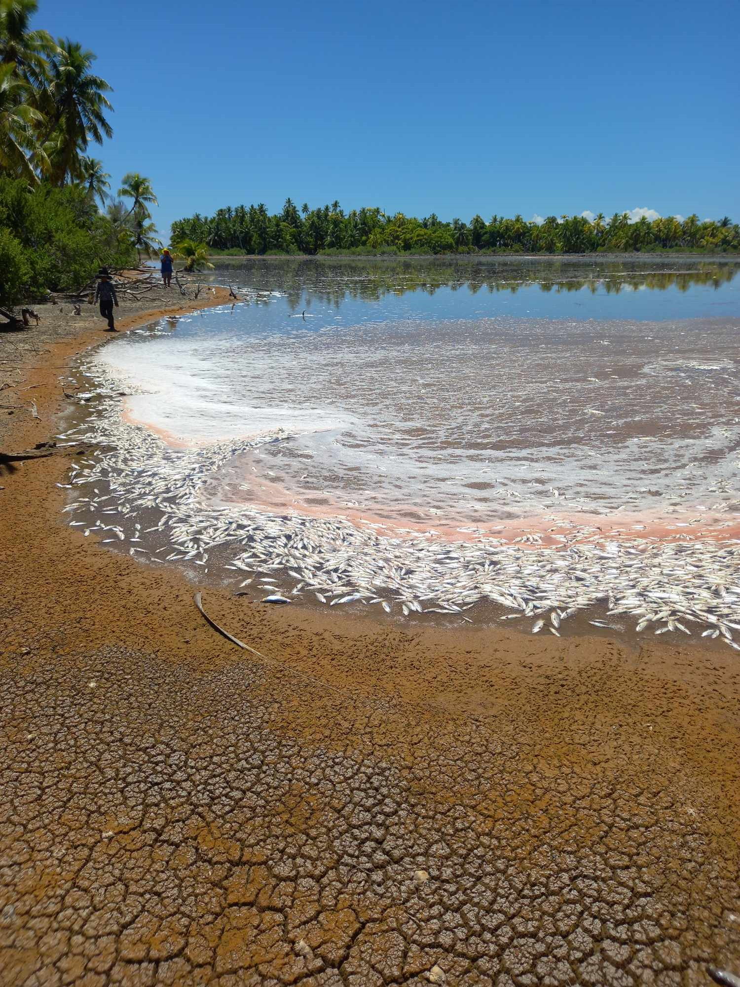
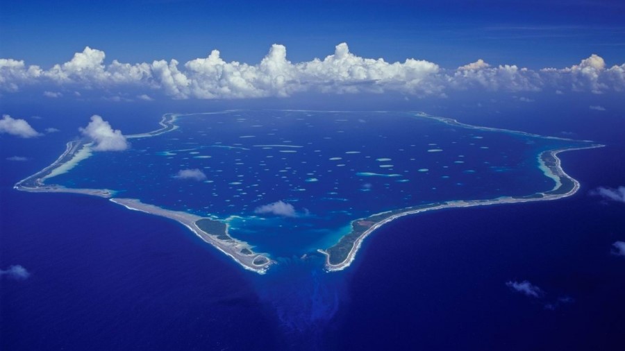
Mass milkfish die-off in Penrhyn raises concerns
3 April 2024

Regulator defends Starlink users
9 April 2024


Aitutaki’s heritage preserved in new anthology
4 January 2024

Avatiu Eels retain Nines title
8 January 2024

Beddoes crowned top athlete
8 January 2024

NRL player Dargan dies in Aitutaki motorcycle crash
24 December 2023

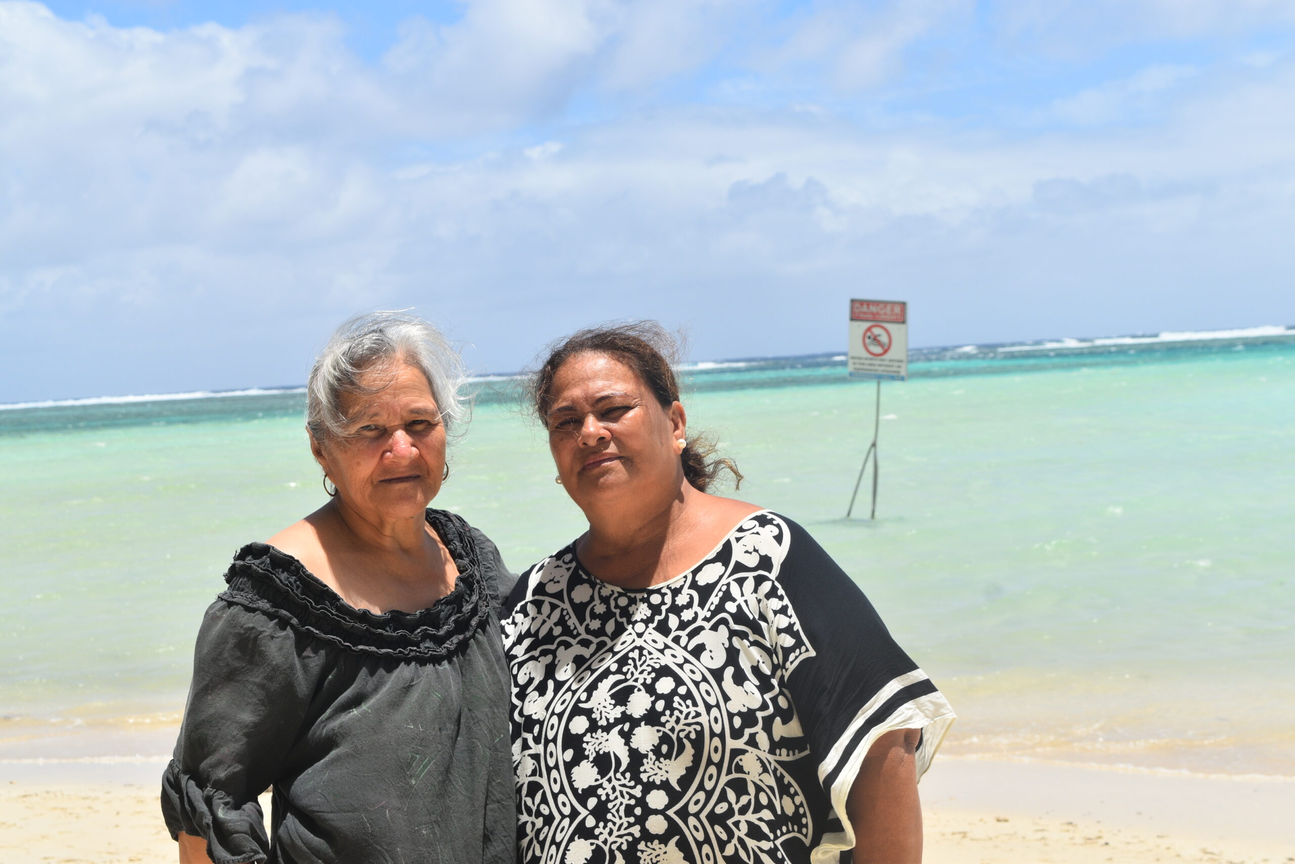
‘Please heed the signs’: resident makes plea to tourists
20 December 2023

Cook Islands set to play in new World Series
10 October 2023


Corruption report exposes ‘bribe and sexual favours’
17 January 2023
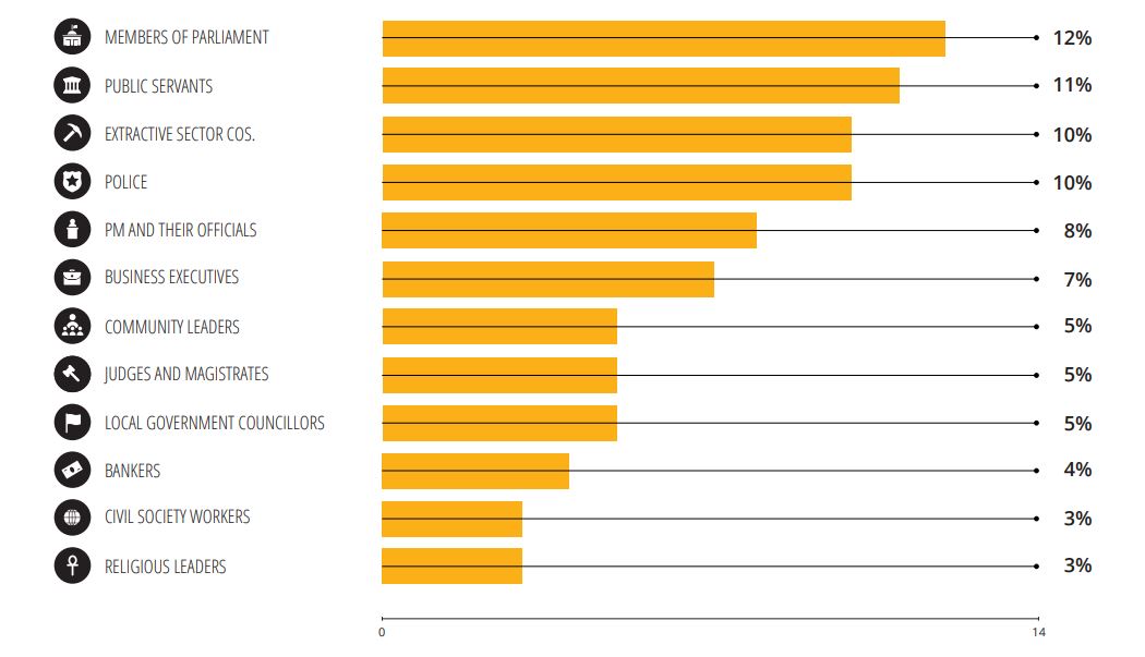
Corruption in the Cook Islands?
21 January 2023

Moana target 2025 World Cup
11 November 2022
A tropical depression is forecast to become Typhoon Goni as it moves through the Marianas this weekend.
GUAM – Just one week after Typhoon Soudelor raked the Northern Marianas, Taiwan and southeast China, the tropical western Pacific is recharging, with a pair of systems likely to become twin typhoons in the days ahead.
Even as cleanup efforts continue, Saipan is once again under a typhoon watch.
Both systems have now become tropical depressions, numbered 16W and 17W by the US military’s Joint Typhoon Warning Centre. Both are located several hundred miles east of the Mariana Islands and heading west.
The first storm to become a tropical storm would be named Goni.
The second would be Atsani.
The most immediate concern is with Tropical Depression 16W, the system closer to the Marianas, as it approaches the islands this weekend.
The National Weather Service has issued a typhoon watch for Saipan and Tinian, meaning typhoon-force winds of 120kph or greater are possible within 48 hours.
The agency has also issued a tropical storm watch farther south for Guam and Rota.
This couldn’t be worse news for Saipan, still struggling to recover from Typhoon Soudelor, www.weather.com reports.
Power outages and a lack of running water and food have plagued the 70-square-kilometre island about 220km northeast of Guam since an intensifying Soudelor hit the island square on August 2.
Tropical Depression 16W is forecast to become a tropical storm – and eventually Typhoon Goni – as it moves through the Marianas this weekend.
Unfortunately, like Soudelor, this new system may begin to undergo a period of rapid intensification just as it crosses the northern part of that island chain, including Saipan.
On Sapian, marines from the USS Ashland, who are assisting with the delivery of food, water and supplies to residents affected by Soudelor, will remain on Saipan during the oncoming bad weather to continue the aid effort – however, the vessel has reportedly set out to sea to avoid major damage from the approaching storm.
Governor Eddie Calvo on Friday encouraged Guam residents to take precautionary measures and clear their yards of debris, and to be careful on Guam’s roads.
“We know that thousands of public school students will be starting the school year on Monday and many parents will be taking their children to get uniforms and back-to-school supplies,” Calvo said in the release. “Please be careful as you’re driving around.”
But that’s just the first system. What about its twin to the east, Tropical Depression 17W?
While it’s much too far out in time to be certain, current indications suggest the eastern system, instead of following in the wake of the first system, may instead track more toward the northwest next week.
This would be well northeast of Saipan and Guam, if it holds true.
Brandon Aydlett, a meteorologist at the National Weather Service, said both circulations are part of a seasonal monsoon trough moving across Micronesia.
“This really puts us in the bullseye for heavy showers and strong winds through next week,” Aydlett said.
Including Halola migrating westward from the central Pacific basin, there have already been 14 named storms so far this year in the Northwest Pacific basin.
Ten of those became typhoons – equivalent to hurricanes – and five of those (Maysak, Noul, Dolphin, Nangka and Soudelor) became “super typhoons”, packing sustained winds estimated of at least 240kph.