

More Top Stories

Solar power battery repairs ‘could take up to 12 months’
15 April 2024


Police shortage leads to drop in checkpoints
9 April 2024


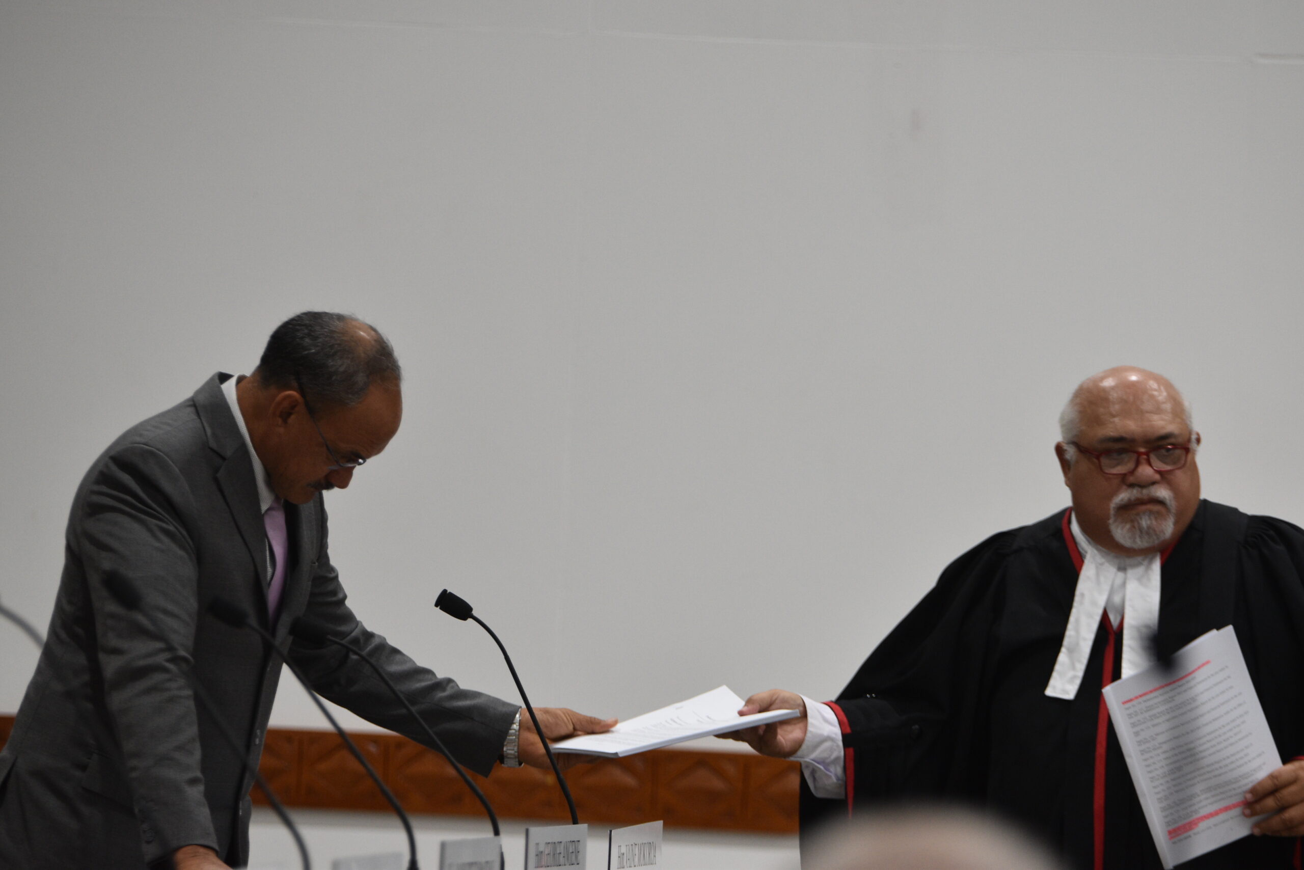
Sarakura declared new Penrhyn MP
16 March 2024

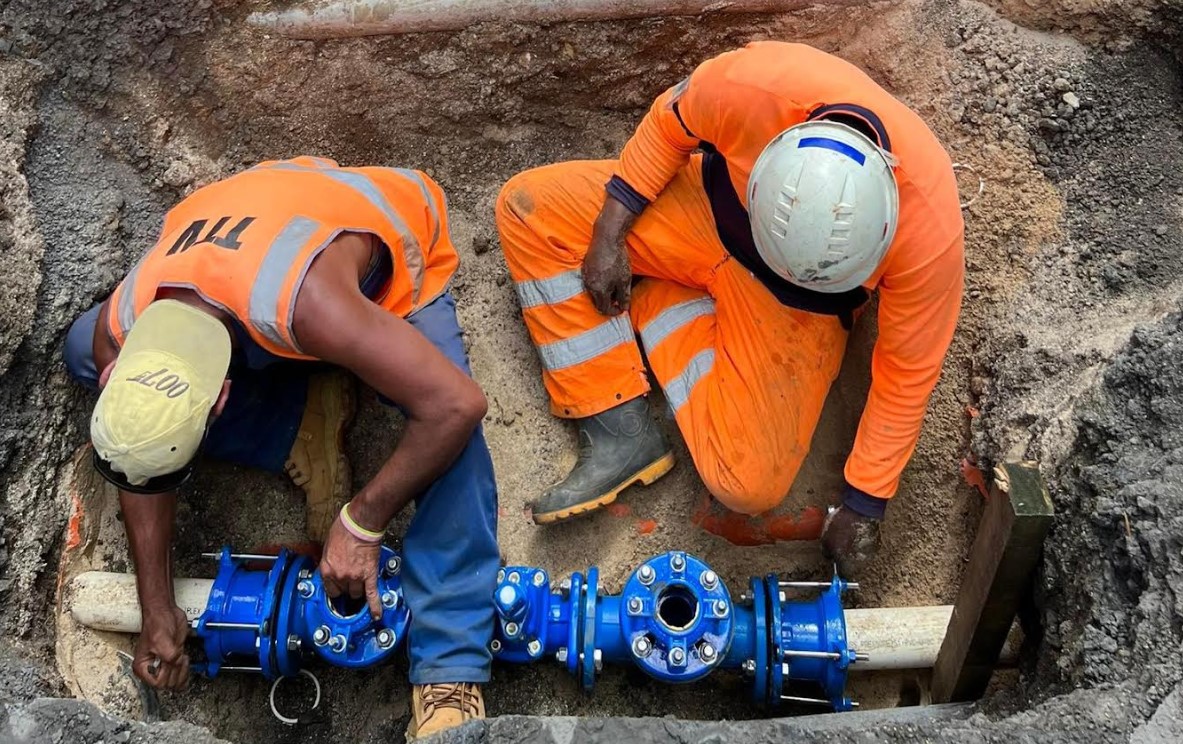
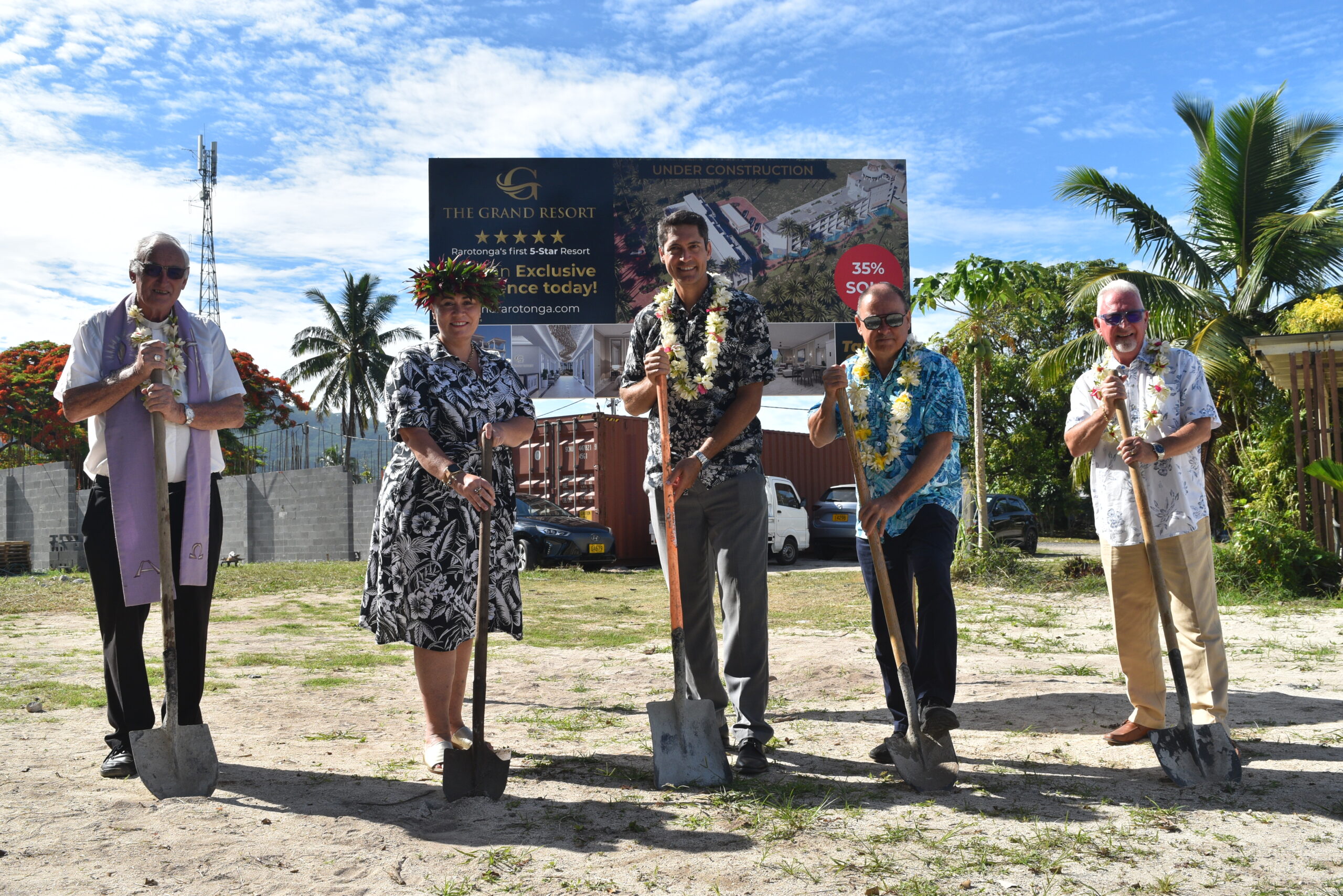
Govt says $1.3m invested in Lady Samoa charter
22 February 2024

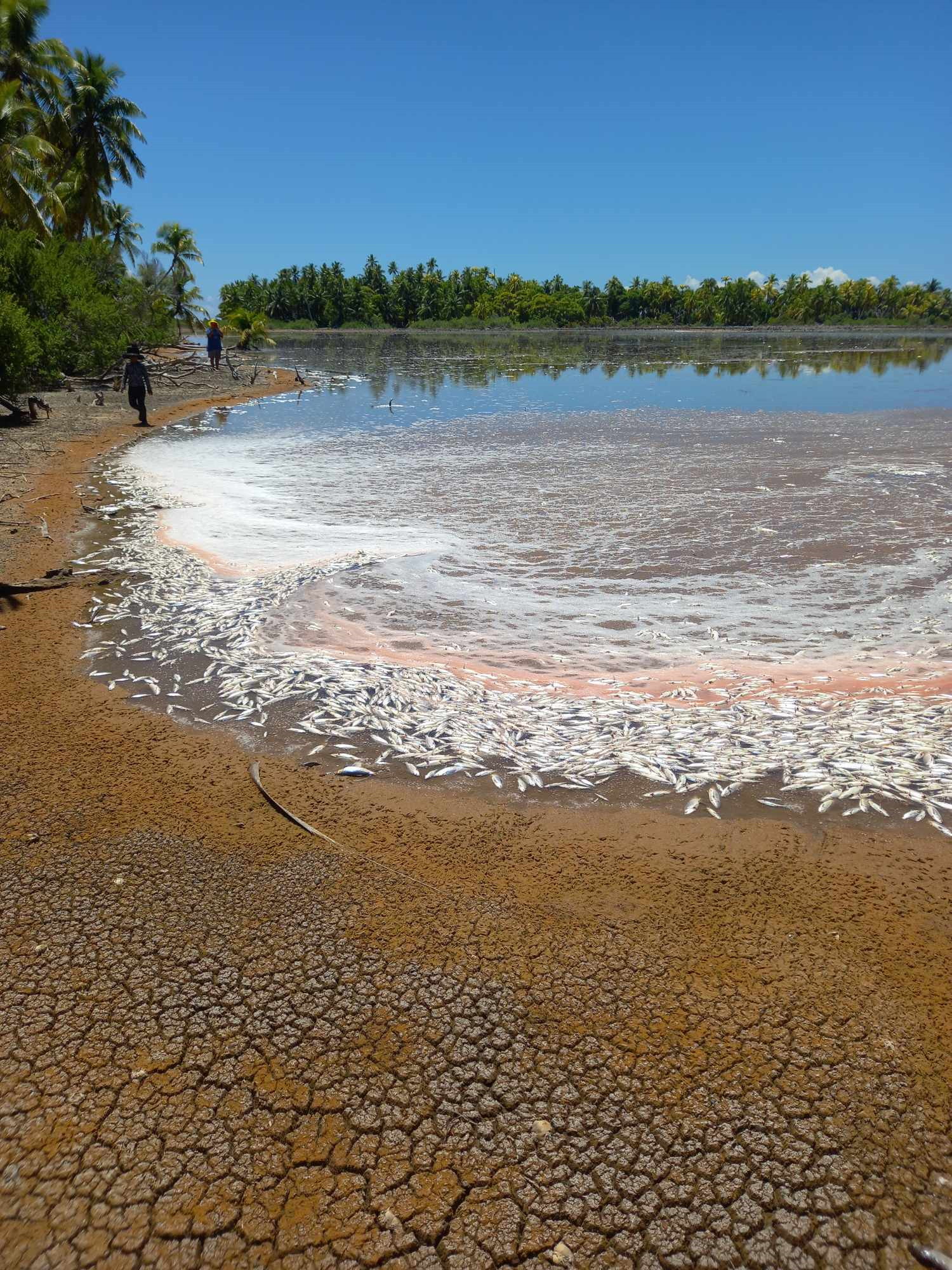
Mass milkfish die-off in Penrhyn raises concerns
3 April 2024

Regulator defends Starlink users
9 April 2024


Aitutaki’s heritage preserved in new anthology
4 January 2024

Avatiu Eels retain Nines title
8 January 2024

Beddoes crowned top athlete
8 January 2024

NRL player Dargan dies in Aitutaki motorcycle crash
24 December 2023

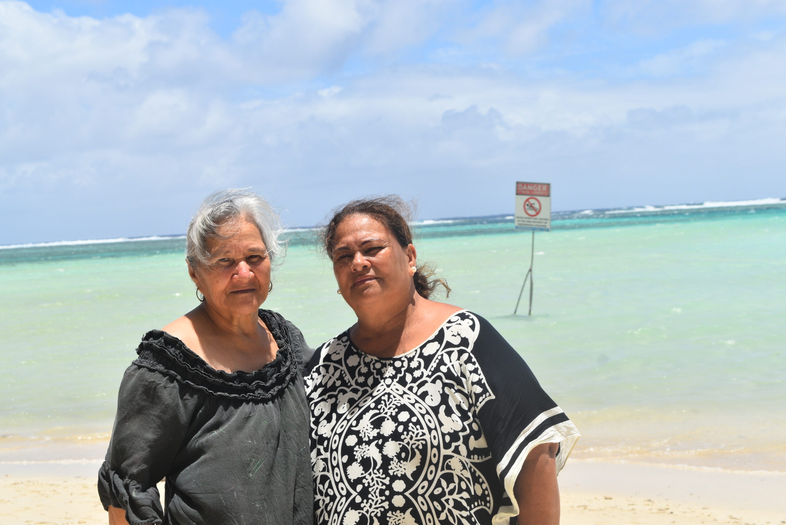
‘Please heed the signs’: resident makes plea to tourists
20 December 2023

Cook Islands set to play in new World Series
10 October 2023


Corruption report exposes ‘bribe and sexual favours’
17 January 2023
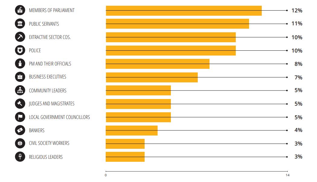
Corruption in the Cook Islands?
21 January 2023

Moana target 2025 World Cup
11 November 2022
AUSTRALIA – Queenslanders are waking up to a huge clean up following the “monster” cyclone Debbie, as the now ex-tropical cyclone still brings heavy rain as it works its way through the state.
At 3.00am on Wednesday morning (local time) the Bureau of Meteorology downgraded Debbie out of the cyclone category to a tropical low, bringing sustained winds of 55kph with gusts of up to 85kph. Heavy rains are still expected as it moves southwest, with a severe weather warning in place.
Heavy rain and damaging winds will continue to hammer Queensland’s Central Coast, the Whitsundays, Central Highlands and Coalfields districts as ex- tropical cyclone Debbie heads south.
Early on Wednesday the Bureau of Meteorology said the tropical low system had moved over inland central Queensland, bringing the risk of flash flooding with up to 250mm of rainfall in a day possible.
As the system continues moving south it could bring major flooding to Ayr, and towns along the NSW border later in the week.
Areas around the southeast coast, such as Brisbane and the Sunshine Coast, could see falls between 50mm to 150mm in the next four days,” Weatherzone meteorologist Graeme Brittain told the Courier Mail.
“Damaging winds are also a possibility for this region, particularly coastal parts.”
On Tuesday night, as the storm approached, Queensland Premier Annastacia Palaszczuk predicted “shock and awe” in the state when the full extent of the devastation wrought by the cyclone is revealed.
At its most ferocious the cyclone downed trees, stripped buildings and left shorelines swamped after making landfall as a category four storm at midday on Tuesday near Airlie Beach.
The state’s premier and police commissioner issued grave warnings to residents. The premier, who on Monday warned it would be a “monster”, said the state would be dealing with the impact of the “scary” cyclone for the next three to five days as it moved down the coast.
“I think there is going to be a lot of shock and awe in the morning,” she told Ten News on Tuesday.
She said rapid assessment teams would be sent to observe the damage at first light on Wednesday.
The system, downgraded to category one at midnight Tuesday night, continued its inland push with winds near the centre of 85kph, gusting up to 120kph.
It was moving west southwest at 15kph.
As a category two storm it had earlier smashed the mining town of Collinsville, ripping the roofs off houses, the Top Pub and a local supermarket.
Police Commissioner Ian Stewart said the storm conditions were still too dangerous for police and emergency services to operate fully in many areas between Bowen and Mackay.
“The loss of power, the loss of phone connectivity means that there could be people right now who are in difficult and dangerous and tragic situations – we just don’t know about it,” he said.
He said one Proserpine man was hurt badly by a collapsing wall and had been taken to the local hospital and also warned the very destructive storm would cause immense damage and possibly kill people.
“I think that we will also receive more reports of injury, if not deaths,” Commissioner Stewart said.
Queensland Fire and Emergency Services Inspector Mark Halverson said crews were still assessing the damage but Proserpine and Shute Harbour were among the worst affected.
“Proserpine and Shute Harbour do definitely have significant damage,” he said.
While Townsville escaped and Mackay was spared the worst, the Whitsundays and Airlie Beach copped the full brunt. Whitsundays councillor John Collins said the wind was “like a jumbo jet on my roof”.
“I’ve been through a few cyclones that are quick and nasty but this one is going to go all day.”
More than 45,000 homes were without power during the worst of the storm.
- PNC sources